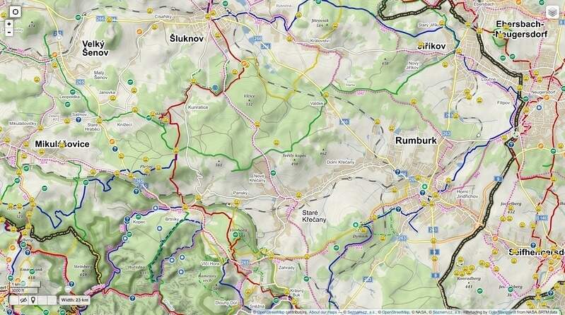
a hromada krmení pro něj. Buď zkopírovat celé i s [] nebo jednotlivé řádky bez čárky na konci. Samozřejmně si můžete jednotlivé podklady vybrat i v samotném GME... Nejužitečnější z mapových podkladů je IMHO Mapy.cz cykloturisticka EU a Topomapy ČUZK :) [{"alt":"Mapy.cz základní","tileUrl":"http://m{s}.mapserver.mapy.cz/base-m/{z}-{x}-{y}","minZoom":5,"maxZoom":18,"subdomains":"1234","attribution":" © Seznam.cz,a.s, © Přispěvatelé OpenStreetMap, © NASA","ignore":false},
{"alt":"Mapy.cz turistická","tileUrl":"http://m{s}.mapserver.mapy.cz/turist_trail-m/{z}-{x}-{y}","minZoom":5,"maxZoom":18,"subdomains":"1234","attribution":"
 © Seznam.cz,a.s, © Přispěvatelé OpenStreetMap, © NASA","ignore":false},
{"alt":"Mapy.cz cykloturistická","tileUrl":"http://m{s}.mapserver.mapy.cz/turist_trail_bike-m/{z}-{x}-{y}","minZoom":5,"maxZoom":18,"subdomains":"1234","attribution":"
 © Seznam.cz,a.s, © Přispěvatelé OpenStreetMap, © NASA","ignore":false},
{"alt":"Mapy.cz cykloturisticka EU", "tileUrl":"http://m{s}.mapserver.mapy.cz/wturist-m/{z}-{x}-{y}", "minZoom":5, "maxZoom":18, "subdomains":"1234", "attribution":" © Seznam.cz,a.s, © Přispěvatelé OpenStreetMap, © NASA"},
{"alt":"Mapy.cz dopravní","tileUrl":"http://m{s}.mapserver.mapy.cz/base-m/{z}-{x}-{y}?s=0.2&dm=Luminosity","minZoom":5,"maxZoom":18,"subdomains":"1234","attribution":"
 © Seznam.cz,a.s, © Přispěvatelé OpenStreetMap, © NASA","ignore":false},
{"alt":"Mapy.cz letní","tileUrl":"http://m{s}.mapserver.mapy.cz/turist_aquatic-m/{z}-{x}-{y}","minZoom":5,"maxZoom":18,"subdomains":"1234","attribution":"
 © Seznam.cz,a.s, © Přispěvatelé OpenStreetMap, © NASA","ignore":false},
{"alt":"Mapy.cz zimní","tileUrl":"http://m{s}.mapserver.mapy.cz/turist_winter-m/{z}-{x}-{y}","minZoom":5,"maxZoom":18,"subdomains":"1234","attribution":"
 © Seznam.cz,a.s, © Přispěvatelé OpenStreetMap, © NASA","ignore":false},
{"alt":"Mapy.cz zeměpisná","tileUrl":"http://m{s}.mapserver.mapy.cz/zemepis-m/{z}-{x}-{y}","minZoom":5,"maxZoom":18,"subdomains":"1234","attribution":"
 © Seznam.cz,a.s, © Přispěvatelé OpenStreetMap, © NASA","ignore":false},
{"alt":"Mapy.cz letecká","tileUrl":"http://m{s}.mapserver.mapy.cz/ophoto-m/{z}-{x}-{y}","minZoom":5,"maxZoom":20,"subdomains":"1234","attribution":"
 © Seznam.cz,a.s, © GEODIS BRNO,s.r.o.","ignore":false},
{"alt":"Mapy.cz letecká 2006","tileUrl":"http://m{s}.mapserver.mapy.cz/ophoto0406-m/{z}-{x}-{y}","minZoom":5,"maxZoom":19,"subdomains":"1234","attribution":"
 © Seznam.cz,a.s, © GEODIS BRNO,s.r.o.","ignore":true},
{"alt":"Mapy.cz letecká 2003","tileUrl":"http://m{s}.mapserver.mapy.cz/ophoto0203-m/{z}-{x}-{y}","minZoom":5,"maxZoom":19,"subdomains":"1234","attribution":"
 © Seznam.cz,a.s, © GEODIS BRNO,s.r.o.","ignore":true},
{"alt":"Mapy.cz letecká popisky","tileUrl":"http://m{s}.mapserver.mapy.cz/hybrid-m/{z}-{x}-{y}","minZoom":5,"maxZoom":20,"subdomains":"1234","attribution":"
 © Seznam.cz,a.s, © GEODIS BRNO,s.r.o.","overlay":true,"ignore":false},
{"alt":"2. vojenské mapování","tileUrl":"http://m{s}.mapserver.mapy.cz/army2-m/{z}-{x}-{y}","minZoom":5,"maxZoom":15,"subdomains":"1234","attribution":"
 © 2nd Military Survey, © Datový podklad MŽP ČR, © Laboratoř geoinformatiky UJEP","ignore":true},
{"alt":"Topomapy ČUZK","tileUrl":"http://geoportal.cuzk.cz/WMS_ZM10_PUB/WMService.aspx","crs":"EPSG:4326","layers":"GR_ZM10","format":"image/png","transparent":false,"attribution":"","overlay":false,"ignore":false,"minZoom":15,"maxZoom":17},
{"alt":"Map1.EU","tileUrl":"http://beta.map1.eu/tiles/{z}/{x}/{y}.jpg","minZoom":5,"maxZoom":15,"attribution":"Maps from Map1.EU and contributors CC-BY-SA","ignore":false},
{"alt":"Kompass","tileUrl":"http://ec2.cdn.ecmaps.de/WmsGateway.ashx.jpg?Experience=kompass&MapStyle=KOMPASS%20Touristik&TileX={x}&TileY={y}&ZoomLevel={z}","minZoom":6,"maxZoom":15,"attribution":"Kompass","ignore":false},
{"alt":"ClWebMap","tileUrl":"http://static2.clweb.cz/mps/mapa_cz/zakladni/{z}/{x}/{x}_{y}.gif","name":"clw","ignore":false},
{"alt":"Toursprung","tileUrl":"http://tile02-cdn.maptoolkit.net/terrain/{z}/{x}/{y}.png","minZoom":2,"maxZoom":17,"attribution":"OpenStreetMap NPE","ignore":false},
{"alt":"Freemap Slovakia Hiking","tileUrl":"http://t{s}.freemap.sk/T/{z}/{x}/{y}.jpeg","attribution":"Map © Freemap Slovakia, data © OpenStreetMap contributors","subdomains":"1234","minZoom":8,"maxZoom":16,"ignore":false},
{"alt":"Freemap Slovakia Bicycle","tileUrl":"http://t{s}.freemap.sk/C/{z}/{x}/{y}.jpeg","attribution":"Map © Freemap Slovakia, data © OpenStreetMap contributors","subdomains":"1234","minZoom":8,"maxZoom":16,"ignore":false},
{"alt":"Freemap Slovakia Car","tileUrl":"http://t{s}.freemap.sk/A/{z}/{x}/{y}.jpeg","attribution":"Map © Freemap Slovakia, data © OpenStreetMap contributors","subdomains":"1234","minZoom":8,"maxZoom":16,"ignore":false},
{"alt":"MapQuest","tileUrl":"https://otile{s}-s.mqcdn.com/tiles/1.0.0/osm/{z}/{x}/{y}.jpg","name":"mpqosm","subdomains":"1234","ignore":true},
{"alt":"MapQuest Aerial","tileUrl":"https://otile{s}-s.mqcdn.com/tiles/1.0.0/sat/{z}/{x}/{y}.jpg","name":"mpqa","subdomains":"1234","ignore":true},
{"alt":"OpenStreetMap","tileUrl":"https://{s}.tile.openstreetmap.org/{z}/{x}/{y}.png","name":"osm","subdomains":"abc","ignore":false},
{"alt":"OpenCycleMap","tileUrl":"https://tile.thunderforest.com/cycle/{z}/{x}/{y}.png","name":"ocm","ignore":false},
{"alt":"Bing Maps","tileUrl":"https://ecn.t{s}.tiles.virtualearth.net/tiles/r{q}?g=864&mkt=en-gb&lbl=l1&stl=h&shading=hill&n=z","subdomains":"0123","minZoom":1,"maxZoom":20,"attribution":"Bing map data copyright Microsoft and its suppliers","name":"bingmap","ignore":true},
{"alt":"Bing Aerial View","tileUrl":"https://ecn.t{s}.tiles.virtualearth.net/tiles/a{q}?g=737&n=z","subdomains":"0123","minZoom":1,"maxZoom":20,"attribution":"Bing map data copyright Microsoft and its suppliers","name":"bingaerial","ignore":true},
{"alt":"Google Maps","tileUrl":"https://mt.google.com/vt?&x={x}&y={y}&z={z}","name":"googlemaps","attribution":"Google Maps","subdomains":"1234","tileSize":256,"maxZoom":22,"ignore":false},{"alt":"Google Satellite","tileUrl":"https://mt.google.com/vt?lyrs=s&x={x}&y={y}&z={z}","name":"googlemapssat","attribution":"Google Maps Satellite","subdomains":"1234","tileSize":256,"maxZoom":22,"ignore":false},
{"alt":"London Street Maps","tileUrl":"https://ecn.t{s}.tiles.virtualearth.net/tiles/r{q}?g=864&productSet=mmCB","subdomains":"0123","minZoom":14,"maxZoom":17,"attribution":"Bing map data copyright Microsoft and its suppliers","name":"binglondon","ignore":true},
{"alt":"Google labels","tileUrl":"http://mt1.google.com/vt/lyrs=h@218000000&hl=en&src=app&x={x}&y={y}&z={z}&s=","overlay":true,"attribution":"Google Maps","ignore":false},
{"alt":"Hillshading","tileUrl":"https://toolserver.org/~cmarqu/hill/{z}/{x}/{y}.png","attribution":"Hillshading by <a\t href='https://wiki.openstreetmap.org/wiki/Hike_%26_Bike_Map'>Colin Marquardt from NASA SRTM data","overlay":true,"ignore":false}]


